Decrease in Trade After Nuclear Test
Imagery Suggests Downtick in Chinese-North Korean Economic Interaction since January 2016 Nuclear Test.
Dandong, China, remains the epicenter of cross-border economic transactions between China and North Korea, where regular boat, railway, and road traffic is witnessed. In the wake of North Korea’s fourth nuclear test on January 6th, the international community responded on March 2, 2016, with UN Security Council Resolution 2270 imposing additional sanctions on North Korea to complement those already in place. These sanctions are designed to shape North Korean calculations in an effort to curb their nuclear weapon activities and abide by their international commitments. The burning question for analysts remains: How well will UN members implement and enforce these sanctions, especially China, North Korea’s biggest trading partner?
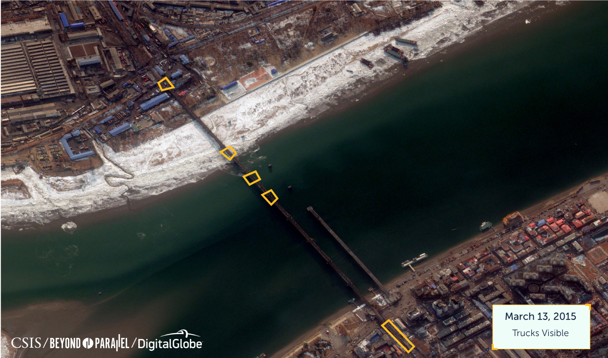
To assess the impact of international sanctions on this economic activity, Beyond Parallel commissioned satellite imagery from January 15, 2015, March 13, 2015, and February 14, 2016, to evaluate the level of cross-border commercial activity between Dandong, China. and Sinuiju, North Korea. Rail, boat, and truck activity in the January and March 2015 imagery offers a baseline for activity, as this imagery was taken prior to North Korea’s January 2016 nuclear test. 
OVERVIEW OF AREAS OF INTEREST
The imagery shows six areas of interest that were examined to assess changes in activity.
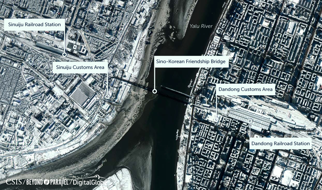
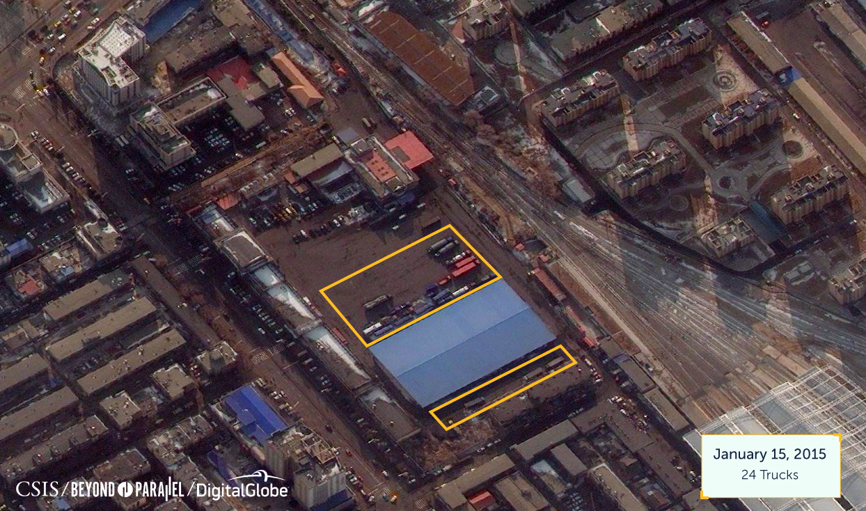
Six specific areas were examined to assess potential presence of trade: Sinuiju Cheongnyeon Railroad Station, Sinuiju Customs Area, Sino-Korean Friendship Bridge, Dandong Customs Area, Dandong Railroad Station, and the Yalu River that separates the cities. North Korea-China trade was measured by the presence of 1) railcars at the stations; 2) trucks in customs areas; 3) trucks on the bridge; and 4) undocked boats in the Yalu River. Imagery analysis resulted in two particularly interesting conclusions.
First, the satellite images indicate a substantive reduction of economic activity on the Sino-North Korean border measured by the fewer trucks, trains, and boats in the February 2016 image compared to a similar timeframe in 2015. While snowfall was present in both cities in the later image, this can be assumed not to be a factor leading to reduced trade because other roads have been plowed and cars are seen on the city streets. In the aftermath of North Korea’s January 2016 nuclear test, this observed downturn in activity was comprehensive across customs areas, railway, and road traffic.
Second, the images also suggest that independent Chinese actions were taken to reduce trade in this region after the nuclear test and prior to China’s signing on to UN Security Council Resolution 2270. These findings run contrary to some estimates that Sino-North Korean trade (particularly Chinese exports) increased in the first quarter of 2016, and might confirm large anomalies in trade data as reported by China’s customs statistics, KOTRA (Korea Trade-Investment Promotion Agency), and other organizations. Trends in North Korea data tend to be incomplete and opaque, especially for economic indicators. Adjusting our aperture to include data from satellite imagery can help supplement existing information, bringing on-the-ground reality into clearer focus. With a clearer understanding of events taking place in the region, policymakers and stakeholders can better plan for the future, including planning for unification.
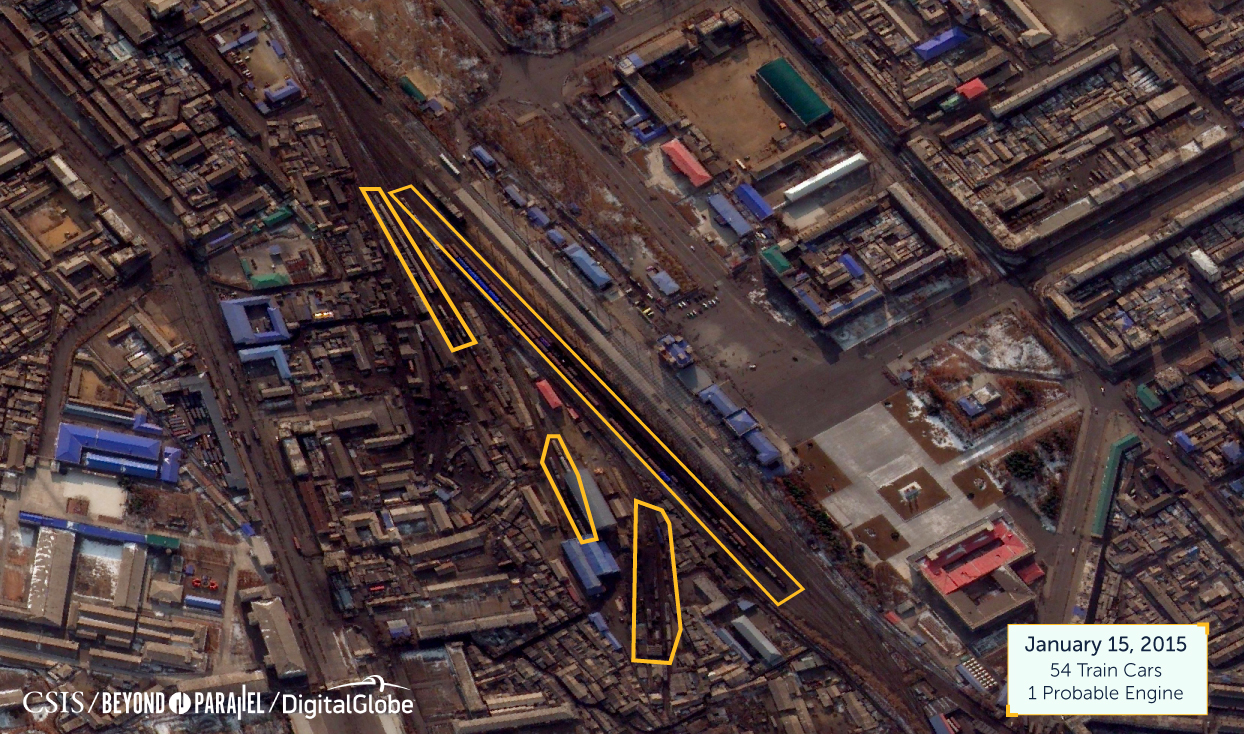
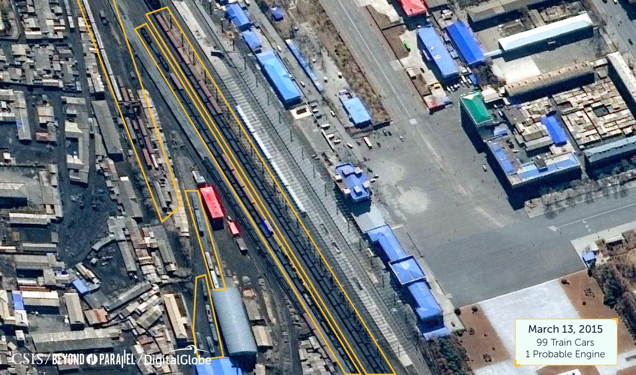
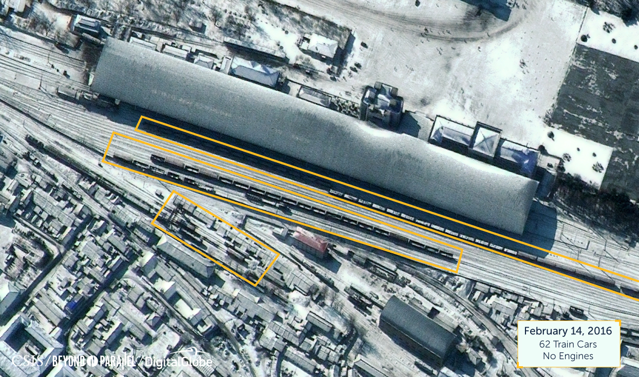
SINUIJU RAIL STATION, NORTH KOREA
The imagery shows more railcars on the tracks prior to the January 2016 nuclear test than after the test. Moreover, while railcars are still observable on the tracks in February 2016, there appear to be no engines, suggesting a halt to train traffic as the remaining cars are only being stored on the tracks.
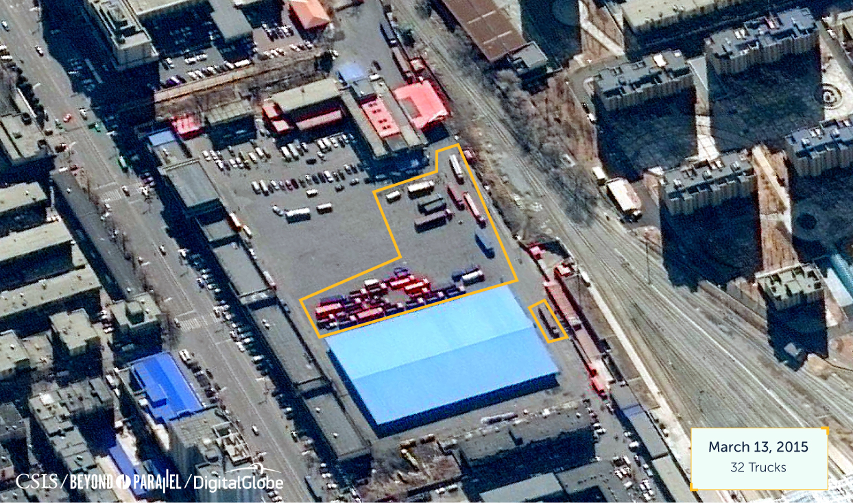
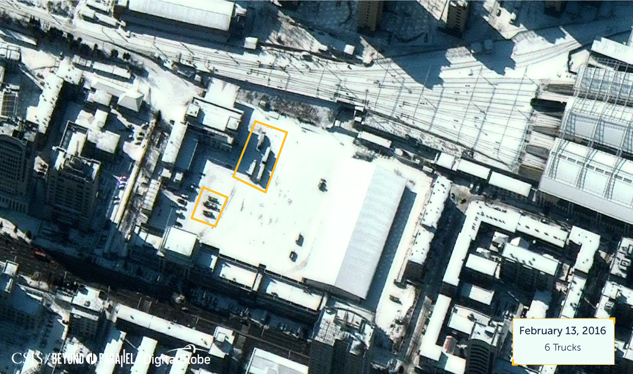
DANDONG CUSTOMS AREA, CHINA
Imagery of the Dandong customs area shows a significant decline in activity after the January 2016 nuclear test. While the January 2015 and March 2015 images show many trucks and cars in the customs area, there are only six trucks there in February 2016. Moreover, there are few tire tracks in the snow in the latest imagery, suggesting low levels of activity overall.
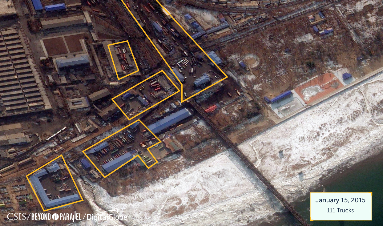
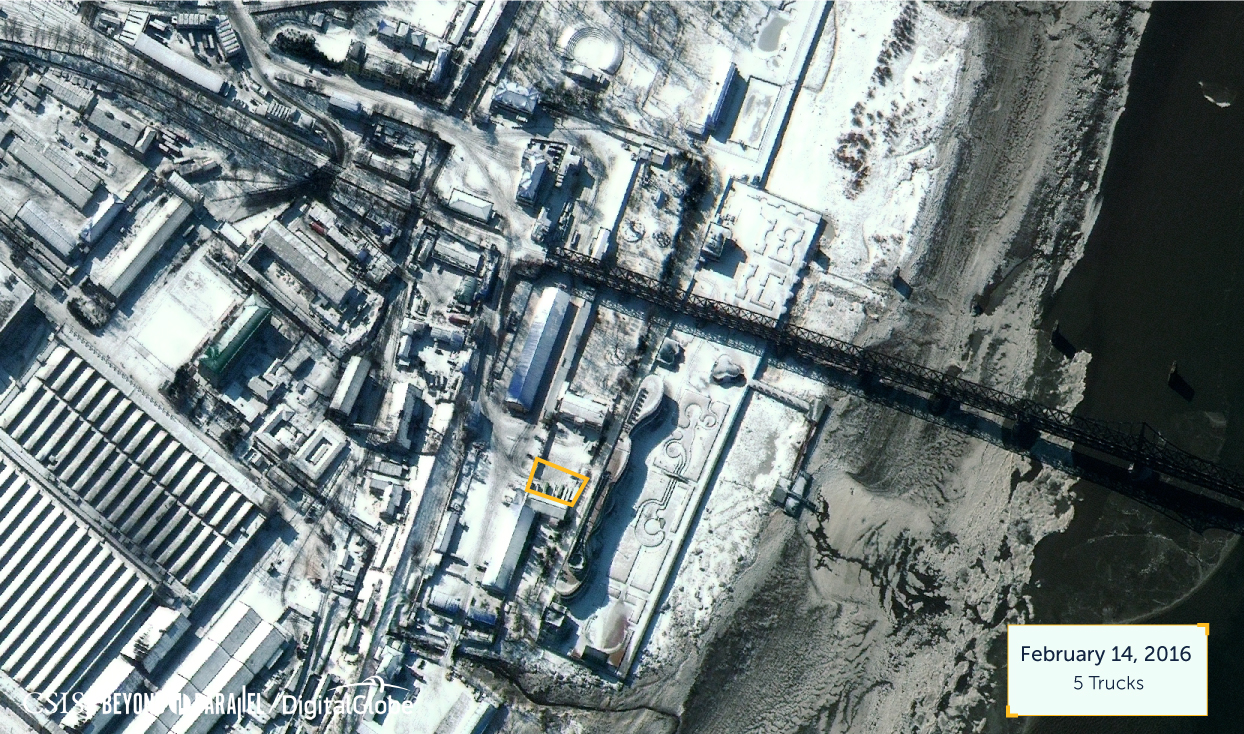
SINUIJU CUSTOMS AREA, NORTH KOREA
Imagery of Sinuiju customs area shows a significant decline in activity after the January 2016 nuclear test. While the January 2015 and March 2015 images show many trucks and cars in the customs area, there are only five trucks there in February 2016.
SINO-KOREAN FRIENDSHIP BRIDGE
There is no observable truck traffic on the Friendship Bridge after the nuclear test. However, given the few trucks observable on the bridge before the test, we cannot conclude that there is now a definitive absence of bridge use.

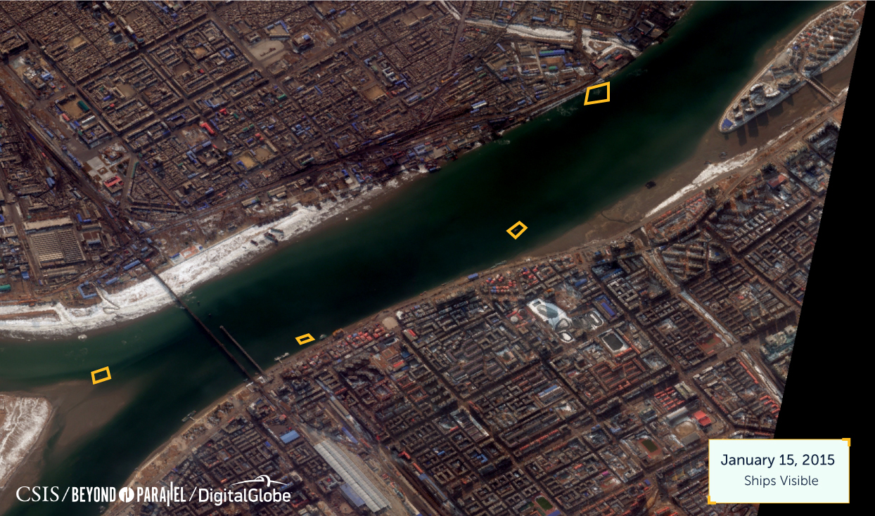
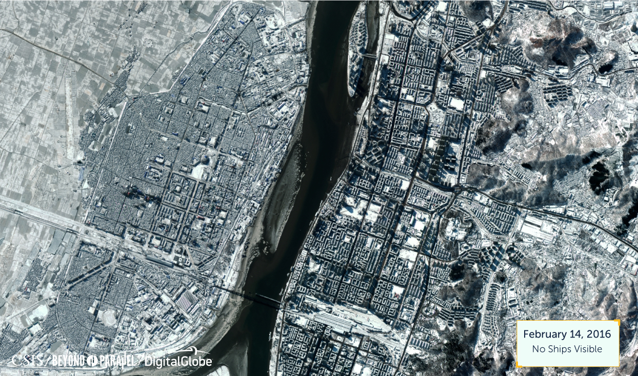
YALU RIVER
Historical analysis shows some boat traffic in the river and docked along the side of each border in 2015. In February 2016, no boat traffic is observed. The few boats overall, however, do not confirm the absence of trade on the river.