March 11, 2020, by Joseph S. Bermudez Jr.—
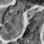
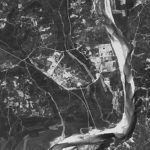
Declassified April 1972 satellite imagery the Yongbyon Nuclear Research Center show developments which taken as a whole continue to represent both an ongoing first-phase construction project for the facility and early infrastructure development efforts within a longer-term plan for future expansion. This work laid the foundations for the construction of the facility’s first waste storage facility in the years to follow and the massive second phase expansion that would begin during the early-1980s.
October 22, 2019, by Joseph S. Bermudez Jr.—
Collected 14 months after the image provided in Part 5 (November 21, 1968) this March 17, 1970 KH-4B image of the Yongbyon Nuclear Research Center shows continued expansion within the village of Sang-dong, minor improvements in the operations, administration/laboratory and support areas, slowly continuing construction of the bridge across the Kuryong-gang and minor infrastructure improvements in the Pungang-ni area. Taken as a whole, these developments continue to indicate an ongoing first-phase construction project for the facility and very early infrastructure development efforts within a longer-term plan for future expansion.
September 25, 2019, by Joseph S. Bermudez Jr.—
Collected eleven months after the image provided in Part 4 (December 10, 1967) this November 21, 1968 KH-4B image of the Yongbyon Nuclear Research Center does not show any significant developments in the operations (with the IRT-2000 research reactor), support or administrative/laboratory areas. It does, however, show continuing development within the village of Sang-dong and the early stages of construction for a new road bridge across the Kuryong-gang in the Pungang-ni area that will connect the support area to the opposite side of the river. Taken as a whole, these developments represent both continuation of a first-phase construction project for the facility and the earliest infrastructure development stages within a longer-term plan for future expansion.
July 18, 2019, by Joseph S. Bermudez Jr.—
Acquired almost two years after the image provided in Yongbyon Declassified Part III (February 11, 1966), this December 10, 1967 image of the Yongbyon Nuclear Research Center is one of the first acquired by the improved reconnaissance KH-4B. Among other improvements, the resolution of the newer KH-4B was 1.8 meters versus 2.7 meters of the earlier KH-4A allowing for considerably better image quality.
June 20, 2019, by Joseph S. Bermudez Jr.—
Acquired seven months after the image provided in Yongbyon Declassified Part II (August 23, 1965) this 2.7-meter resolution image covers the Yongbyon area on February 11, 1966. While the general area remains primarily engaged in agricultural activity typical of rural North Korea during the 1960s, significant construction activity is observed at the nascent Yongbyon Nuclear Research Center and adjacent village of Sang-dong.
July 16, 2018, by Joseph S. Bermudez Jr. and Beyond Parallel—
North Korea’s pursuit of a nuclear weapons program is nearly six decades old. While archival documents have previously provided some evidence of North Korea’s intent to build weapons of mass destruction at an early stage in the Cold War, newly declassified satellite imagery from the Central Intelligence Agency gives us a more precise picture of how and exactly when North Korea started developing the fundamental components of its nuclear weapons program.
May 14, 2018, by Joseph S. Bermudez Jr. and Beyond Parallel—
The exact origins of North Korea’s nuclear program are still shrouded in mystery despite being the object of study for over twenty-five years. Contrary to common perception, early satellite imagery from the Central Intelligence Agency, taken on December 15, 1962 and June 27, 1963, shows that construction on the Yongbyon Nuclear Research Center in North Korea started sometime after June 27, 1963 and before July 16, 1964.
April 23, 2018, by Joseph S. Bermudez Jr. and Beyond Parallel—
Despite being the subject of intense study for almost 60 years there is remarkably little independently verifiable information concerning the development of North Korea’s nuclear infrastructure available at the unclassified level. This series of reports entitled "Yongbyon Declassified," tries to rectify that by examining high-resolution satellite imagery acquired by early U.S. reconnaissance programs.
