Yongbyon Declassified Part V: Expansion Begins Across the Kuryong-gang
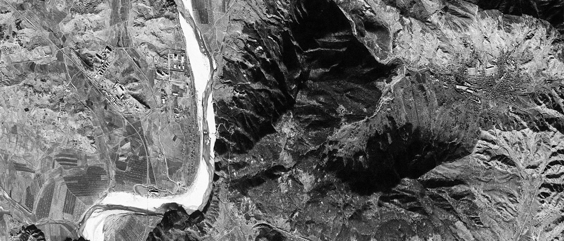
KH-4B Mission 1105, November 21, 1968
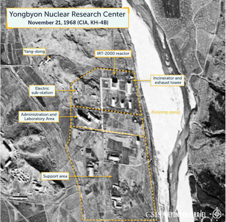
Collected eleven months after the image provided in Yongbyon Declassified Part IV (December 10, 1967) this November 21, 1968 KH-4B image of the Yongbyon Nuclear Research Center does not show any significant developments in the operations (with the IRT-2000 research reactor), support or administrative/laboratory areas. It does, however, show continuing development within the village of Sang-dong and the early stages of construction for a new road bridge across the Kuryong-gang in the Pungang-ni area that will connect the support area to the opposite side of the river. Taken as a whole, these developments represent both continuation of a first-phase construction project for the facility and the earliest infrastructure development stages within a longer-term plan for future expansion.

Within the operations area, no observable changes are noted to the IRT-2000 reactor building, associated support buildings and the electric sub-station to the west of the reactor. However, while not apparent in this image, in 2010 the Korea Institute for National Unification indicated that during 1968 North Korea installed a “small-scale critical assembly from the Soviet Union” at Yongbyon. Immediately south of this, in the administrative/laboratory area, no observable changes are noted to the first of several buildings. All the structures in both these areas appear to be externally complete and are likely operational. As is the basic road network connecting them.

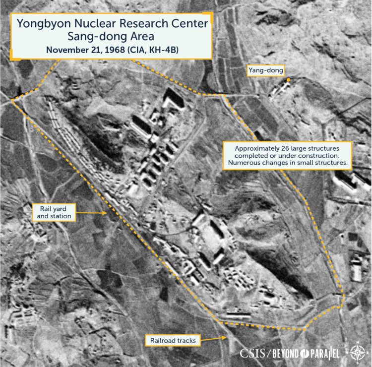
Within the town of Sang-dong construction of new buildings for housing, government and cultural usage continues at a moderate pace. As of November 21, 1968, there are approximately 26 large buildings. There have also been minor changes among the town’s smaller structures.
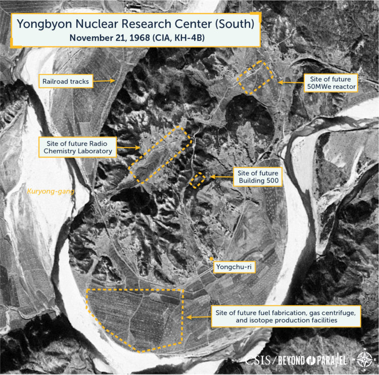
The area south of the operations and administrative/laboratory areas, around the village of Pungang-ni, is both the developing support area for the facility and the site for the future 5MWe and ELWR reactors. While no new support structures or roads are observed in the November 21, 1968 image, a new road bridge has begun construction that will connect the support area to the area across the Kuryong-gang (Kuryong River) to the southeast. Construction of the bridge appears to have begun from the east bank and includes an access road to the site. The construction of the bridge likely represents the earliest infrastructure development stage within a long-term project for the expansion of the Yongbyon Nuclear Research Center. No activity of significance is observed in the area southeast of the bridge that will house the future Radiochemistry Laboratory, 50MWe reactor, fuel fabrication, centrifuge and other related facilities.
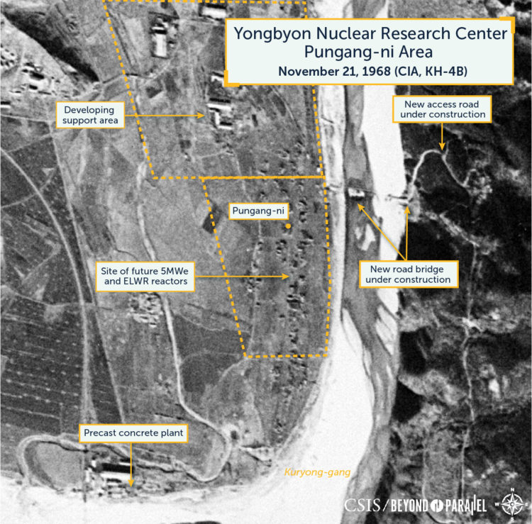
Southwest of the Pungang-ni area, on the bank of the Kuryong-gang is a precast concrete plant that appears to be operational. It likely produces preformed concrete components and other products used in construction projects in Sang-dong, the Yongbyon Nuclear Research Center and the general area. Sand and gravel for the plant is supplied by dredging operations in the Kuryong-gang.