Yongbyon Declassified Part IV: Continued Construction Observed into 1967
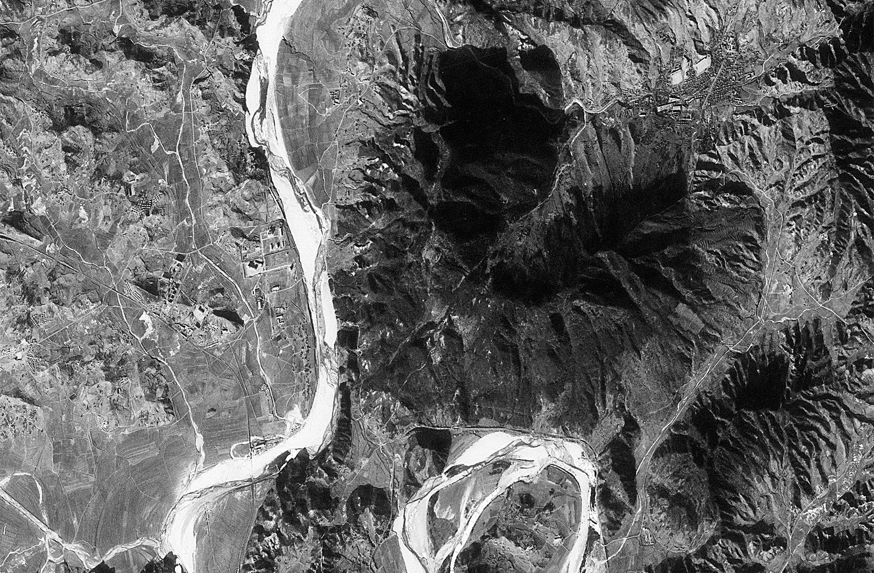
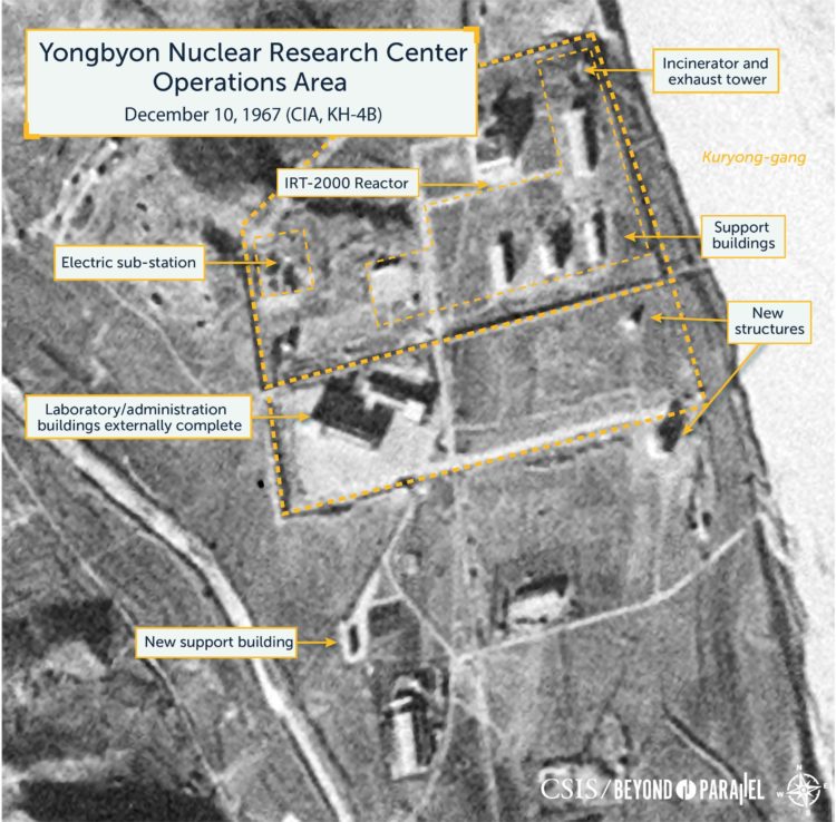
KH-4B Mission 1102, December 10, 1967
Acquired almost two years after the image provided in Yongbyon Declassified Part III (February 11, 1966), this December 10, 1967 image of the Yongbyon Nuclear Research Center is one of the first acquired by the improved reconnaissance KH-4B.1 Among other improvements, the resolution of the newer KH-4B was 1.8 meters versus 2.7 meters of the earlier KH-4A allowing for considerably better image quality.2
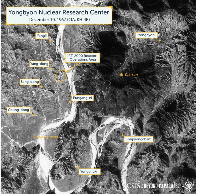
While the area around the Yongbyon Nuclear Research Center remains primarily engaged in agricultural activity, continuing construction activity is observed at the facility’s Operations Area, Support Area, and within the village of Sang-dong. No activity of significance is noted in the area to the southeast and across the Kuryong-gang—the site of future nuclear related facilities.
At the Operations Area, the IRT-2000 reactor building and six support buildings are externally complete. South Korean sources indicate that the reactor became operational during 1967. This may be supported by the position of the support crane on top of the reactor building that has changed.3 The electric sub-station to the west of the reactor may also be complete.
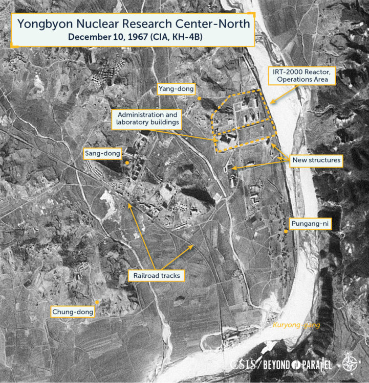
South of the Operations Area, construction on the first laboratory/administration buildings appear to be externally complete. Immediately to the east, two small structures have been newly built. These appear to be the first stages of larger buildings to be constructed in the upcoming years. Approximately 250 meters south of the laboratory/administration buildings, a second small support building has been erected. The road to this and the other buildings in the support area appears to have been improved.
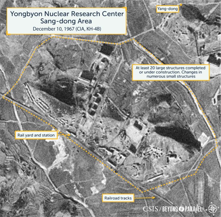
Within the town of Sang-dong construction of new buildings for housing, government and cultural usage slowly continues, and there are now approximately 20 large buildings completed or under construction. Numerous changes are also noted among the small structures (typically housing) along the south and southwest side of the town.
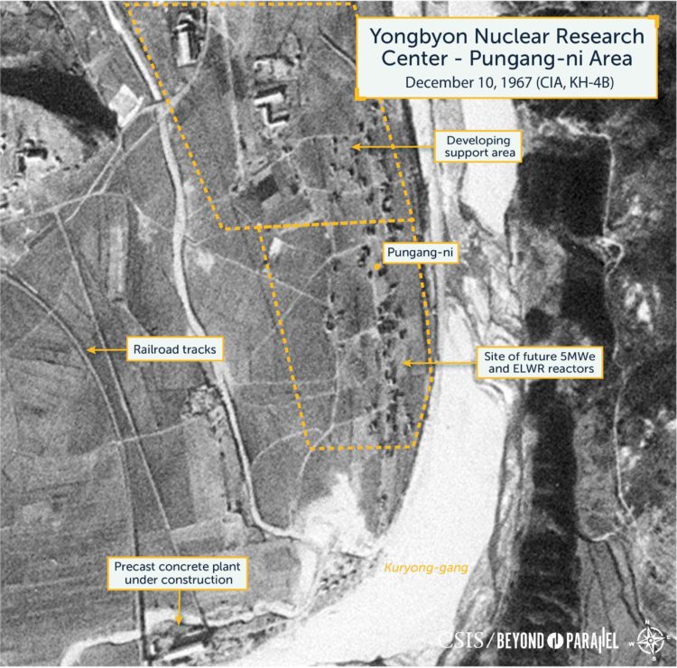
The area around the village of Pungang-ni (site for the future 5MWe and ELWR reactors) remains engaged in agricultural activity. Southwest of Pungang-ni, on the shore of the Kuryong-gang, the precast concrete plant appears to be externally complete. It likely produces preformed concrete components and other products used in construction projects in Sang-dong, the Yongbyon Nuclear Research Center and the general area. Sand and gravel for the plant is supplied by dredging operations in the Kuryong-gang.
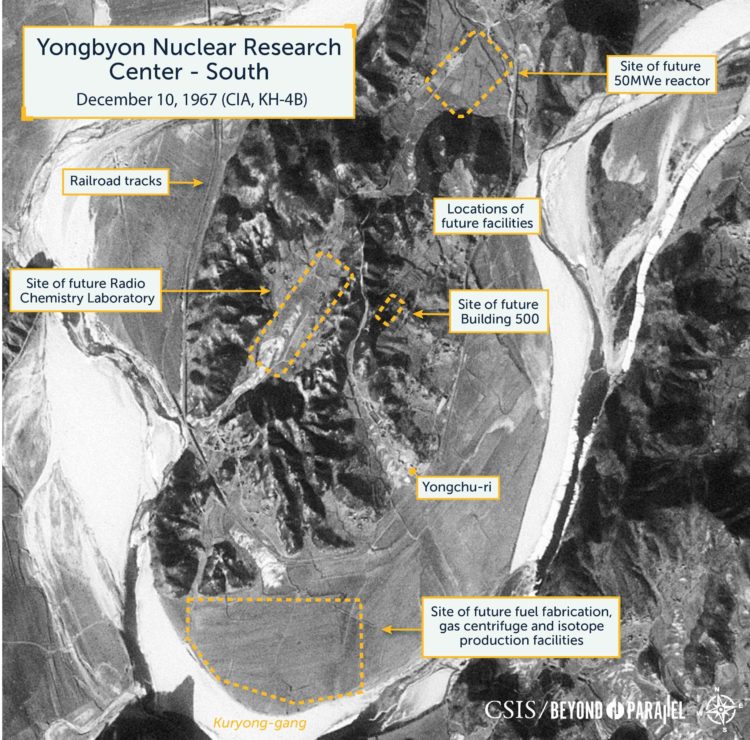
No activity of significance is observed in the area across the Kuryong-gang (Kuryong River) to the southeast. This area will house the future Radiochemistry Laboratory, 50MWe reactor, fuel fabrication, and other related facilities.
References
- Last updated July 31, 2019. ↩
- While we are all familiar with the high-resolution imagery easily available today to the world using Google Earth and similar tools, it should be remembered that during the 1960s a 1.8 meter resolution image taken from space was truly remarkable. As with almost all overhead imagery quality is significantly affected by environmental conditions (e.g., cloud cover, moisture in the atmosphere, pollution, etc.) and how far off-nadir the image was taken from. ↩
- Cho Min and Kim Chin-ha, Chronicle of the North Korean Nuclear Issue 1955-2009, (Seoul: Center for Unification Policy Studies), 2010. ↩